Tennessee Landforms -- waterfalls| WGS84 |
| 36.358400 | -84.956900 |
| 36° 21.504'N | 84° 57.414'W |
| 36° 21' 30.2"N | 84° 57' 24.8"W |
| 16S 683315E 4025640N |
| convert to NAD27 |
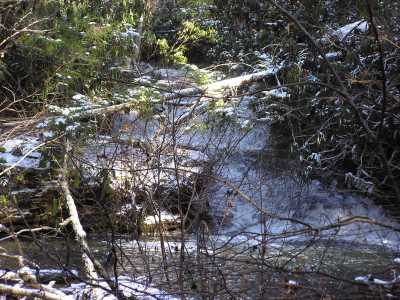
Fern Camp Cascade 20'
Waypoint: FEF009 36.358400,-84.956900
County: Fentress landforms of Fentress county
Locale: private
popup list of
nearby landforms (mileage, bearing)
MAPS
Select one of the following maps to display this waypoint (WGS84).
GPS
Remarks:
Tennessee landforms
home
arches
waterfalls
rocks
peaks
balds
sinks
lakes
regions
county
GSMNP landforms (TN/NC)
BSF landforms (TN/KY)
or nearby
lookout towers
Chuck Sutherland's www.tnlandforms.com the future (2024)
 ©
Tom Dunigan
©
Tom Dunigan