Tennessee Landforms -- waterfalls| WGS84 |
| 36.334892 | -84.878370 |
| 36° 20.094'N | 84° 52.702'W |
| 36° 20' 5.6"N | 84° 52' 42.1"W |
| 16S 690419E 4023183N |
| convert to NAD27 |
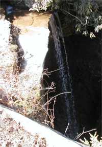
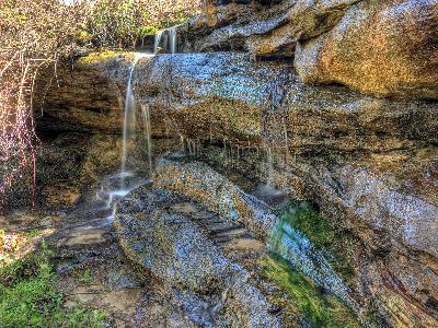
Mountain View Falls 25'
Waypoint: FEF003 36.334892,-84.878370
County: Fentress landforms of Fentress county
Locale: private
popup list of
nearby landforms (mileage, bearing)
MAPS
Select one of the following maps to display this waypoint (WGS84).
GPS
Remarks:
Chris Oliver reports a wet-weather falls on a nearby branch at
36.334621,-84.885485
Tennessee landforms
home
arches
waterfalls
rocks
peaks
balds
sinks
lakes
regions
county
GSMNP landforms (TN/NC)
BSF landforms (TN/KY)
or nearby
lookout towers
Chuck Sutherland's www.tnlandforms.com the future (2024)
 ©
Tom Dunigan
©
Tom Dunigan