Tennessee Landforms -- waterfalls| WGS84 |
| 36.363711 | -84.889734 |
| 36° 21.823'N | 84° 53.384'W |
| 36° 21' 49.4"N | 84° 53' 23"W |
| 16S 689329E 4026358N |
| convert to NAD27 |
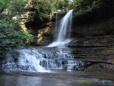
Magendanz Falls 35'
Waypoint: FEF001 36.363711,-84.889734
County: Fentress landforms of Fentress county
Locale: private
popup list of
nearby landforms (mileage, bearing)
MAPS
Select one of the following maps to display this waypoint (WGS84).
GPS
Remarks:
Tennessee landforms
home
arches
waterfalls
rocks
peaks
balds
sinks
lakes
regions
county
GSMNP landforms (TN/NC)
BSF landforms (TN/KY)
or nearby
lookout towers
Chuck Sutherland's www.tnlandforms.com the future (2024)
 ©
Tom Dunigan
©
Tom Dunigan