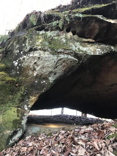
An opening through a small ridge on the east side of the ravine. The arch is 15' wide and 15' through the ridge. Opening is 1' to 3' high.
| WGS84 | |
| 36.522700 | -84.867300 |
| 36° 31.362'N | 84° 52.038'W |
| 36° 31' 21.7"N | 84° 52' 2.3"W |
| 16S 690952E 4044042N | |
| convert to NAD27 | |
MAPS
Select one of the following maps to display this waypoint (WGS84).
GPS
Remarks:
Reference and photo: ganderson
An opening through a small
ridge on the east side of the ravine. The arch is 15' wide and 15'
through the ridge. Opening is 1' to 3' high.
Cressler's photo