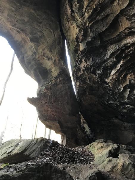
A 30' tall buttress with a 20' tall by 1' wide separation from the main cliff wall. Located on the left side of a large rock shelter.
| WGS84 | |
| 36.522400 | -84.867400 |
| 36° 31.344'N | 84° 52.044'W |
| 36° 31' 20.6"N | 84° 52' 2.6"W |
| 16S 690944E 4044008N | |
| convert to NAD27 | |
MAPS
Select one of the following maps to display this waypoint (WGS84).
GPS
Remarks:
Reference and photo: ganderson
A 30' tall buttress with a
20' tall by 1' wide separation from the main cliff wall. Located on
the left side of a large rock shelter.
Cressler's photo