Tennessee Landforms -- arches and natural bridges| WGS84 |
| 36.502722 | -84.766417 |
| 36° 30.163'N | 84° 45.985'W |
| 36° 30' 9.8"N | 84° 45' 59.1"W |
| 16S 700037E 4042030N |
| convert to NAD27 |
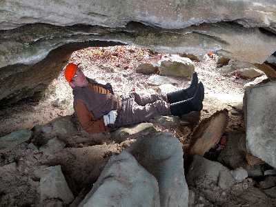
Meditation Arch 12x3
Waypoint: FEA063 36.502722,-84.766417
County: Fentress landforms of Fentress county
Locale: Big South Fork
NABSQNO 16S-700037-4042030
popup list of
nearby landforms (mileage, bearing)
MAPS
Select one of the following maps to display this waypoint (WGS84).
GPS
Remarks:
Reference: Glenn Reider
Tennessee landforms
home
arches
waterfalls
rocks
peaks
balds
sinks
lakes
regions
county
GSMNP landforms (TN/NC)
BSF landforms (TN/KY)
or nearby
lookout towers
Chuck Sutherland's www.tnlandforms.com the future (2024)
 ©
Tom Dunigan
©
Tom Dunigan