Tennessee Landforms -- arches and natural bridges| WGS84 |
| 36.519920 | -84.870540 |
| 36° 31.195'N | 84° 52.232'W |
| 36° 31' 11.7"N | 84° 52' 13.9"W |
| 16S 690668E 4043727N |
| convert to NAD27 |
Biped Arch 4x3
Waypoint: FEA053 36.519920,-84.870540
County: Fentress landforms of Fentress county
Locale: PogueCreek
NABSQNO 16S-690668-4043727
popup list of
nearby landforms (mileage, bearing)
MAPS
Select one of the following maps to display this waypoint (WGS84).
GPS
Remarks:
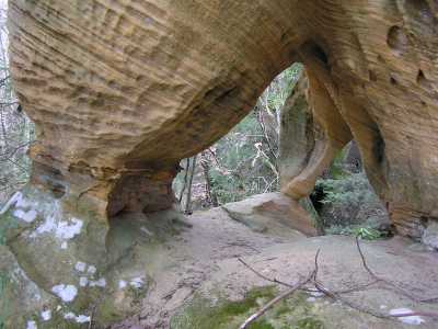 high on bluff
Tennessee landforms
home
arches
waterfalls
rocks
peaks
balds
sinks
lakes
regions
county
GSMNP landforms (TN/NC)
BSF landforms (TN/KY)
or nearby
lookout towers
Chuck Sutherland's www.tnlandforms.com the future (2024)
 ©
Tom Dunigan
©
Tom Dunigan