Tennessee Landforms -- arches and natural bridges| WGS84 |
| 36.546300 | -84.849800 |
| 36° 32.778'N | 84° 50.988'W |
| 36° 32' 46.7"N | 84° 50' 59.3"W |
| 16S 692460E 4046695N |
| convert to NAD27 |
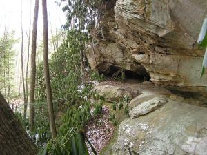
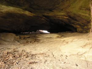
Slitherin Arches 4x2
Waypoint: FEA042 36.546300,-84.849800
County: Fentress landforms of Fentress county
Locale: PogueCreek
NABSQNO 16S-692460-4046695
popup list of
nearby landforms (mileage, bearing)
MAPS
Select one of the following maps to display this waypoint (WGS84).
GPS
Remarks:
A small pair of adjoining arches that you'll have to slither on your
belly to visit.
Tennessee landforms
home
arches
waterfalls
rocks
peaks
balds
sinks
lakes
regions
county
GSMNP landforms (TN/NC)
BSF landforms (TN/KY)
or nearby
lookout towers
Chuck Sutherland's www.tnlandforms.com the future (2024)
 ©
Tom Dunigan
©
Tom Dunigan