Tennessee Landforms -- arches and natural bridges| WGS84 |
| 36.466300 | -84.720500 |
| 36° 27.978'N | 84° 43.23'W |
| 36° 27' 58.7"N | 84° 43' 13.8"W |
| 16S 704246E 4038085N |
| convert to NAD27 |
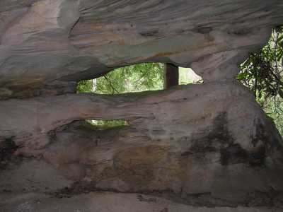
Eyeball Arch 4x1
Waypoint: FEA033 36.466300,-84.720500
County: Fentress landforms of Fentress county
Locale: Big South Fork
NABSQNO 16S-704246-4038085
popup list of
nearby landforms (mileage, bearing)
MAPS
Select one of the following maps to display this waypoint (WGS84).
GPS
Remarks:
Tennessee landforms
home
arches
waterfalls
rocks
peaks
balds
sinks
lakes
regions
county
GSMNP landforms (TN/NC)
BSF landforms (TN/KY)
or nearby
lookout towers
Chuck Sutherland's www.tnlandforms.com the future (2024)
 ©
Tom Dunigan
©
Tom Dunigan