Tennessee Landforms -- arches and natural bridges| WGS84 |
| 36.535500 | -84.836300 |
| 36° 32.13'N | 84° 50.178'W |
| 36° 32' 7.8"N | 84° 50' 10.7"W |
| 16S 693696E 4045524N |
| convert to NAD27 |
Johnson Branch Arches 5x5
Waypoint: FEA032 36.535500,-84.836300
County: Fentress landforms of Fentress county
Locale: PogueCreek
NABSQNO 16S-693696-4045524
popup list of
nearby landforms (mileage, bearing)
MAPS
Select one of the following maps to display this waypoint (WGS84).
GPS
Remarks:
a collection of arches and windows on Johnson Branch in Pogue Creek tract.
off-trail.
recent Nature Conservancy
acquisition.
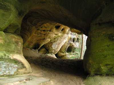
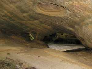

Byron Jorjorian photos
Tennessee landforms
home
arches
waterfalls
rocks
peaks
balds
sinks
lakes
regions
county
GSMNP landforms (TN/NC)
BSF landforms (TN/KY)
or nearby
lookout towers
Chuck Sutherland's www.tnlandforms.com the future (2024)
 ©
Tom Dunigan
©
Tom Dunigan