Tennessee Landforms -- arches and natural bridges| WGS84 |
| 36.529200 | -84.818400 |
| 36° 31.752'N | 84° 49.104'W |
| 36° 31' 45.1"N | 84° 49' 6.2"W |
| 16S 695314E 4044861N |
| convert to NAD27 |
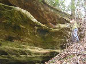
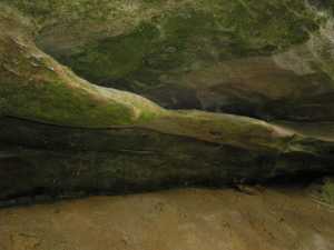
Two Ribs 7x5
Waypoint: FEA030 36.529200,-84.818400
County: Fentress landforms of Fentress county
Locale: PogueCreek
NABSQNO 16S-695314-4044861
popup list of
nearby landforms (mileage, bearing)
MAPS
Select one of the following maps to display this waypoint (WGS84).
GPS
Remarks:
Two small spans, off-trail, Pogue Creek
Tennessee landforms
home
arches
waterfalls
rocks
peaks
balds
sinks
lakes
regions
county
GSMNP landforms (TN/NC)
BSF landforms (TN/KY)
or nearby
lookout towers
Chuck Sutherland's www.tnlandforms.com the future (2024)
 ©
Tom Dunigan
©
Tom Dunigan