Tennessee Landforms -- arches and natural bridges| WGS84 |
| 36.529900 | -84.820850 |
| 36° 31.794'N | 84° 49.251'W |
| 36° 31' 47.6"N | 84° 49' 15.1"W |
| 16S 695093E 4044934N |
| convert to NAD27 |
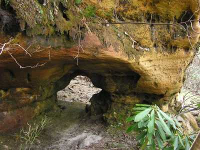
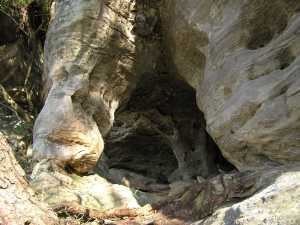
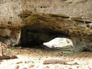
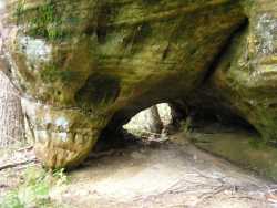
Pogue Holes(5) 3x2
Waypoint: FEA025 36.529900,-84.820850
County: Fentress landforms of Fentress county
Locale: PogueCreek
NABSQNO 16S-695093-4044934
popup list of
nearby landforms (mileage, bearing)
MAPS
Select one of the following maps to display this waypoint (WGS84).
GPS
Remarks:
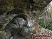
An arch on every corner ... well, many corners or ridge noses have
small column arches. We collect a number of those here, most are about
3' in width.
off-trail, Pogue Creek Tract, recent Nature Conservancy
acquisition.
 36.5299 -84.8208
 36.53098 -84.8376
 36.5317 -84.8364
 36.5303 -84.8243
 36.545 -84.8457
Byron Jorjorian photos
Tennessee landforms
home
arches
waterfalls
rocks
peaks
balds
sinks
lakes
regions
county
GSMNP landforms (TN/NC)
BSF landforms (TN/KY)
or nearby
lookout towers
Chuck Sutherland's www.tnlandforms.com the future (2024)
 ©
Tom Dunigan
©
Tom Dunigan