Tennessee Landforms -- arches and natural bridges| WGS84 |
| 36.427300 | -84.755900 |
| 36° 25.638'N | 84° 45.354'W |
| 36° 25' 38.3"N | 84° 45' 21.2"W |
| 16S 701174E 4033684N |
| convert to NAD27 |
Christian Tunnel 120'
Waypoint: FEA018 36.427300,-84.755900
County: Fentress landforms of Fentress county
Locale: Big South Fork
NABSQNO 16S-701174-4033684
popup list of
nearby landforms (mileage, bearing)
MAPS
Select one of the following maps to display this waypoint (WGS84).
GPS
Remarks:
off-trail arch/tunnel or a rockhouse with a backdoor. tunnel is 120'.
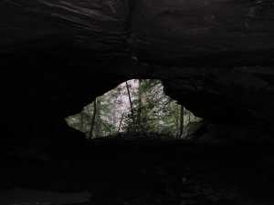 front door
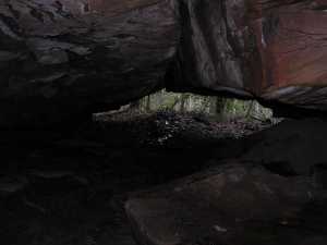 back door
Tennessee landforms
home
arches
waterfalls
rocks
peaks
balds
sinks
lakes
regions
county
GSMNP landforms (TN/NC)
BSF landforms (TN/KY)
or nearby
lookout towers
Chuck Sutherland's www.tnlandforms.com the future (2024)
 ©
Tom Dunigan
©
Tom Dunigan