Tennessee Landforms -- arches and natural bridges| WGS84 |
| 36.510930 | -84.792500 |
| 36° 30.656'N | 84° 47.55'W |
| 36° 30' 39.4"N | 84° 47' 33"W |
| 16S 697680E 4042887N |
| convert to NAD27 |
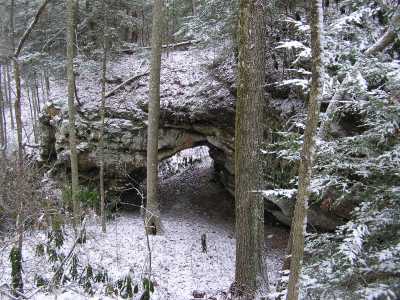
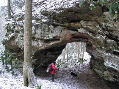
Bill's Knob Arch 18x18
Waypoint: FEA015 36.510930,-84.792500
County: Fentress landforms of Fentress county
Locale: private
NABSQNO 16S-697680-4042887
popup list of
nearby landforms (mileage, bearing)
MAPS
Select one of the following maps to display this waypoint (WGS84).
GPS
Remarks:
Reference: Bob Wheeley, Keith Garnes
Tennessee landforms
home
arches
waterfalls
rocks
peaks
balds
sinks
lakes
regions
county
GSMNP landforms (TN/NC)
BSF landforms (TN/KY)
or nearby
lookout towers
Chuck Sutherland's www.tnlandforms.com the future (2024)
 ©
Tom Dunigan
©
Tom Dunigan