Tennessee Landforms -- arches and natural bridges| WGS84 |
| 36.456700 | -84.837100 |
| 36° 27.402'N | 84° 50.226'W |
| 36° 27' 24.1"N | 84° 50' 13.6"W |
| 16S 693821E 4036780N |
| convert to NAD27 |
Mask Arch 10x2
Waypoint: FEA012 36.456700,-84.837100
County: Fentress landforms of Fentress county
Locale: private
NABSQNO 16S-693821-4036780
popup list of
nearby landforms (mileage, bearing)
MAPS
Select one of the following maps to display this waypoint (WGS84).
GPS
Remarks:
Reference: Keith Garnes
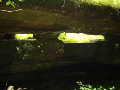
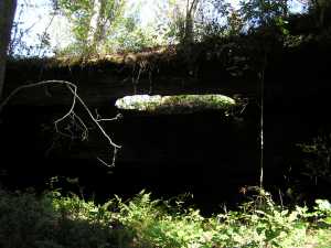
 photo courtesy Brad Neff.
Tennessee landforms
home
arches
waterfalls
rocks
peaks
balds
sinks
lakes
regions
county
GSMNP landforms (TN/NC)
BSF landforms (TN/KY)
or nearby
lookout towers
Chuck Sutherland's www.tnlandforms.com the future (2024)
 ©
Tom Dunigan
©
Tom Dunigan