Tennessee Landforms -- arches and natural bridges| WGS84 |
| 36.414267 | -84.947770 |
| 36° 24.856'N | 84° 56.866'W |
| 36° 24' 51.4"N | 84° 56' 52"W |
| 16S 684002E 4031855N |
| convert to NAD27 |
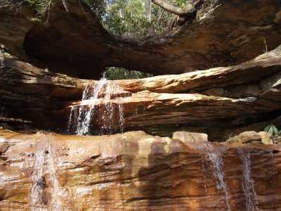
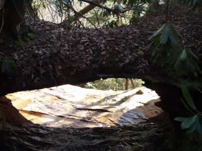
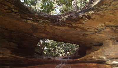
Rockcastle Natural Bridge 11x4
Waypoint: FEA007 36.414267,-84.947770
County: Fentress landforms of Fentress county
NABSQNO 16S-684002-4031855
popup list of
nearby landforms (mileage, bearing)
MAPS
Select one of the following maps to display this waypoint (WGS84).
GPS
Remarks:
References: JNAD:TENN-70,WPA Guide to Tennessee
A small stream passes thru this nartural bridge and then cascades off the bluff.
Approach from the power line (off-trail).
Rockcastle Falls is only
a few hundred feet to the east.
Tennessee landforms
home
arches
waterfalls
rocks
peaks
balds
sinks
lakes
regions
county
GSMNP landforms (TN/NC)
BSF landforms (TN/KY)
or nearby
lookout towers
Chuck Sutherland's www.tnlandforms.com the future (2024)
 ©
Tom Dunigan
©
Tom Dunigan