Tennessee Landforms -- arches and natural bridges| WGS84 |
| 36.445500 | -84.890940 |
| 36° 26.73'N | 84° 53.456'W |
| 36° 26' 43.8"N | 84° 53' 27.4"W |
| 16S 689022E 4035430N |
| convert to NAD27 |
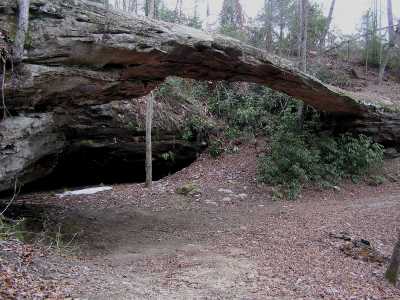
Price's Arch 75x25
Waypoint: FEA006 36.445500,-84.890940
County: Fentress landforms of Fentress county
Locale: private
NABSQNO 16S-689022-4035430
popup list of
nearby landforms (mileage, bearing)
MAPS
Select one of the following maps to display this waypoint (WGS84).
GPS
Remarks:
References: JNAD:TENN-28, WAD:44.8,JNAD 20, John Burns
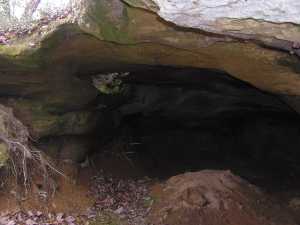 small skylight in rockhouse at
36.4465 -84.89429
small skylight in rockhouse at
36.4465 -84.89429
Tennessee landforms
home
arches
waterfalls
rocks
peaks
balds
sinks
lakes
regions
county
GSMNP landforms (TN/NC)
BSF landforms (TN/KY)
or nearby
lookout towers
Chuck Sutherland's www.tnlandforms.com the future (2024)
 ©
Tom Dunigan
©
Tom Dunigan