Tennessee Landforms -- waterfalls| WGS84 |
| 35.913616 | -85.761881 |
| 35° 54.817'N | 85° 45.713'W |
| 35° 54' 49"N | 85° 45' 42.8"W |
| 16S 611713E 3975075N |
| convert to NAD27 |
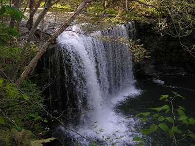
Pine Creek Falls(2) 30'
Waypoint: DKF004 35.913616,-85.761881
County: DeKalb landforms of DeKalb county
Locale: whitewater
popup list of
nearby landforms (mileage, bearing)
MAPS
Select one of the following maps to display this waypoint (WGS84).
GPS
Remarks:
Also known as Andersons Peak or as Cowpie Falls by the kayakers.
Chuck Sutherland
photo of Talent Falls, 35', downstream at
35.913675, -85.760566.
Tennessee landforms
home
arches
waterfalls
rocks
peaks
balds
sinks
lakes
regions
county
GSMNP landforms (TN/NC)
BSF landforms (TN/KY)
or nearby
lookout towers
Chuck Sutherland's www.tnlandforms.com the future (2024)
 ©
Tom Dunigan
©
Tom Dunigan