Tennessee Landforms -- waterfalls| WGS84 |
| 35.944347 | -85.776195 |
| 35° 56.661'N | 85° 46.572'W |
| 35° 56' 39.7"N | 85° 46' 34.3"W |
| 16S 610379E 3978468N |
| convert to NAD27 |
Carmac Falls 90'
Waypoint: DKF001 35.944347,-85.776195
County: DeKalb landforms of DeKalb county
Locale: mill
popup list of
nearby landforms (mileage, bearing)
MAPS
Select one of the following maps to display this waypoint (WGS84).
GPS
Remarks:
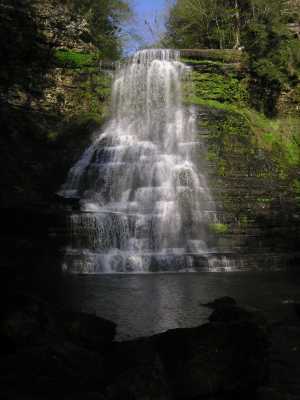 aka, Cul-car-mac Falls
Tennessee landforms
home
arches
waterfalls
rocks
peaks
balds
sinks
lakes
regions
county
GSMNP landforms (TN/NC)
BSF landforms (TN/KY)
or nearby
lookout towers
Chuck Sutherland's www.tnlandforms.com the future (2024)
 ©
Tom Dunigan
©
Tom Dunigan