Tennessee Landforms -- arches and natural bridges| WGS84 |
| 36.493133 | -85.403076 |
| 36° 29.588'N | 85° 24.185'W |
| 36° 29' 35.3"N | 85° 24' 11.1"W |
| 16S 643031E 4039832N |
| convert to NAD27 |
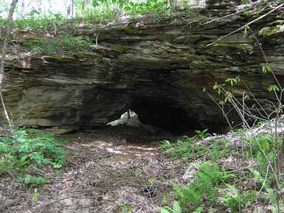
Burchett Natural Bridge 18x6
Waypoint: CYA001 36.493133,-85.403076
County: Clay landforms of Clay county
Locale: private
NABSQNO 16S-643031-4039832
popup list of
nearby landforms (mileage, bearing)
MAPS
Select one of the following maps to display this waypoint (WGS84).
GPS
Remarks:
Tennessee landforms
home
arches
waterfalls
rocks
peaks
balds
sinks
lakes
regions
county
GSMNP landforms (TN/NC)
BSF landforms (TN/KY)
or nearby
lookout towers
Chuck Sutherland's www.tnlandforms.com the future (2024)
 ©
Tom Dunigan
©
Tom Dunigan