Tennessee Landforms -- waterfalls| WGS84 |
| 36.038047 | -84.812956 |
| 36° 2.283'N | 84° 48.777'W |
| 36° 2' 17"N | 84° 48' 46.6"W |
| 16S 697033E 3990381N |
| convert to NAD27 |
Cove Br Falls 40'
Waypoint: CUF010 36.038047,-84.812956
County: Cumberland landforms of Cumberland county
Locale: Catoosa
popup list of
nearby landforms (mileage, bearing)
MAPS
Select one of the following maps to display this waypoint (WGS84).
GPS
Remarks:
Reference and photo: Jason Horton
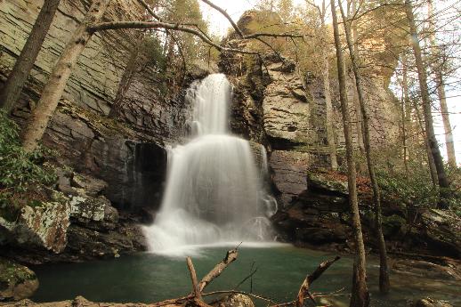 aka Fire Rake Falls
Tennessee landforms
home
arches
waterfalls
rocks
peaks
balds
sinks
lakes
regions
county
GSMNP landforms (TN/NC)
BSF landforms (TN/KY)
or nearby
lookout towers
Chuck Sutherland's www.tnlandforms.com the future (2024)
 ©
Tom Dunigan
©
Tom Dunigan