Tennessee Landforms -- waterfalls| WGS84 |
| 36.018300 | -85.016900 |
| 36° 1.098'N | 85° 1.014'W |
| 36° 1' 5.9"N | 85° 1' 0.8"W |
| 16S 678702E 3987797N |
| convert to NAD27 |
Russell Falls 30'
Waypoint: CUF005 36.018300,-85.016900
County: Cumberland landforms of Cumberland county
Locale: private
popup list of
nearby landforms (mileage, bearing)
MAPS
Select one of the following maps to display this waypoint (WGS84).
GPS
Remarks:
Two wet-weather falls on this greenway easement.
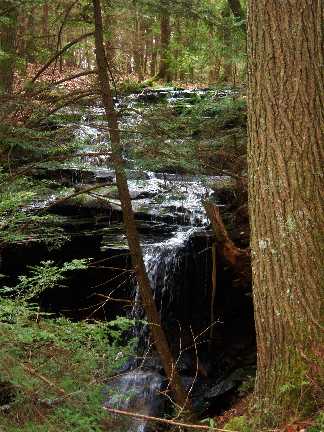 Chris Oliver photo
Tennessee landforms
home
arches
waterfalls
rocks
peaks
balds
sinks
lakes
regions
county
GSMNP landforms (TN/NC)
BSF landforms (TN/KY)
or nearby
lookout towers
Chuck Sutherland's www.tnlandforms.com the future (2024)
 ©
Tom Dunigan
©
Tom Dunigan