Tennessee Landforms -- waterfalls| WGS84 |
| 35.850600 | -84.935800 |
| 35° 51.036'N | 84° 56.148'W |
| 35° 51' 2.2"N | 84° 56' 8.9"W |
| 16S 686404E 3969345N |
| convert to NAD27 |
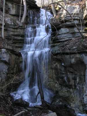
Powder House Falls 40'
Waypoint: CUF004 35.850600,-84.935800
County: Cumberland landforms of Cumberland county
popup list of
nearby landforms (mileage, bearing)
MAPS
Select one of the following maps to display this waypoint (WGS84).
GPS
Remarks:
off-trail falls that emerges from a cave and drops into a sinkhole, part
of Grassy Cove geology.
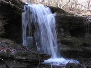 12' upper falls
Tennessee landforms
home
arches
waterfalls
rocks
peaks
balds
sinks
lakes
regions
county
GSMNP landforms (TN/NC)
BSF landforms (TN/KY)
or nearby
lookout towers
Chuck Sutherland's www.tnlandforms.com the future (2024)
 ©
Tom Dunigan
©
Tom Dunigan