Tennessee Landforms -- waterfalls| WGS84 |
| 36.293890 | -82.067380 |
| 36° 17.633'N | 82° 4.043'W |
| 36° 17' 38"N | 82° 4' 2.6"W |
| 17S 404156E 4017074N |
| convert to NAD27 |
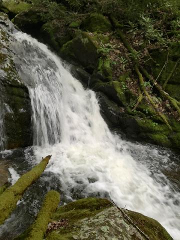
Bubbling Cauldron Falls 18'
Waypoint: CTF023 36.293890,-82.067380
County: Carter landforms of Carter county
Locale: Cherokee National Forest
popup list of
nearby landforms (mileage, bearing)
MAPS
Select one of the following maps to display this waypoint (WGS84).
GPS
Remarks:
Reference: Thomas Mabry and Kitty Myers
 Thomas Mabry photo
Tennessee landforms
home
arches
waterfalls
rocks
peaks
balds
sinks
lakes
regions
county
GSMNP landforms (TN/NC)
BSF landforms (TN/KY)
or nearby
lookout towers
Chuck Sutherland's www.tnlandforms.com the future (2024)
 ©
Tom Dunigan
©
Tom Dunigan