Tennessee Landforms -- waterfalls| WGS84 |
| 36.410890 | -82.114200 |
| 36° 24.653'N | 82° 6.852'W |
| 36° 24' 39.2"N | 82° 6' 51.1"W |
| 17S 400101E 4030100N |
| convert to NAD27 |
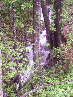
Stone Mtn Br Cascade 10'
Waypoint: CTF021 36.410890,-82.114200
County: Carter landforms of Carter county
Locale: Cherokee National Forest
popup list of
nearby landforms (mileage, bearing)
MAPS
Select one of the following maps to display this waypoint (WGS84).
GPS
Remarks:
Reference & photo: Robert Robbins
Tennessee landforms
home
arches
waterfalls
rocks
peaks
balds
sinks
lakes
regions
county
GSMNP landforms (TN/NC)
BSF landforms (TN/KY)
or nearby
lookout towers
Chuck Sutherland's www.tnlandforms.com the future (2024)
 ©
Tom Dunigan
©
Tom Dunigan