Tennessee Landforms -- waterfalls| WGS84 |
| 36.269180 | -82.129030 |
| 36° 16.151'N | 82° 7.742'W |
| 36° 16' 9.1"N | 82° 7' 44.5"W |
| 17S 398588E 4014396N |
| convert to NAD27 |
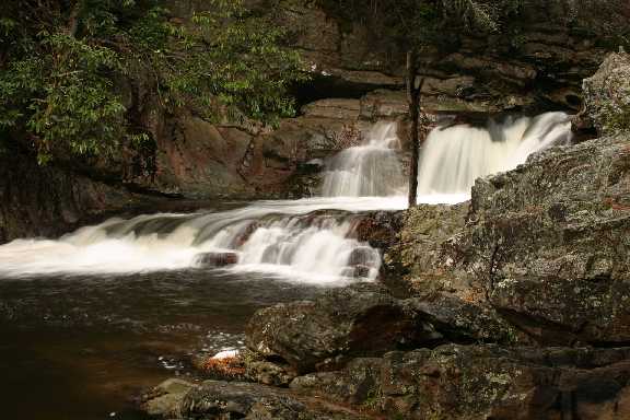
Pats Falls 15'
Waypoint: CTF019 36.269180,-82.129030
County: Carter landforms of Carter county
Locale: wilderness
popup list of
nearby landforms (mileage, bearing)
MAPS
Select one of the following maps to display this waypoint (WGS84).
GPS
Remarks:
Reference and photo: Bill Stowell
Tennessee landforms
home
arches
waterfalls
rocks
peaks
balds
sinks
lakes
regions
county
GSMNP landforms (TN/NC)
BSF landforms (TN/KY)
or nearby
lookout towers
Chuck Sutherland's www.tnlandforms.com the future (2024)
 ©
Tom Dunigan
©
Tom Dunigan