Tennessee Landforms -- waterfalls| WGS84 |
| 36.270900 | -82.132700 |
| 36° 16.254'N | 82° 7.962'W |
| 36° 16' 15.2"N | 82° 7' 57.7"W |
| 17S 398261E 4014591N |
| convert to NAD27 |
Laurel Falls (m) 8'
Waypoint: CTF010 36.270900,-82.132700
County: Carter landforms of Carter county
Locale: wilderness
popup list of
nearby landforms (mileage, bearing)
MAPS
Select one of the following maps to display this waypoint (WGS84).
GPS
Remarks:
Stephen Kasten reports two more falls (6' and 10') about 200' downstream.
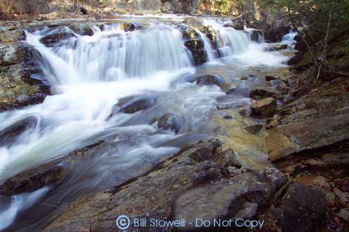 Photo courtesy of Bill Stowell.
Tennessee landforms
home
arches
waterfalls
rocks
peaks
balds
sinks
lakes
regions
county
GSMNP landforms (TN/NC)
BSF landforms (TN/KY)
or nearby
lookout towers
Chuck Sutherland's www.tnlandforms.com the future (2024)
 ©
Tom Dunigan
©
Tom Dunigan