Tennessee Landforms -- waterfalls| WGS84 |
| 36.432900 | -82.072600 |
| 36° 25.974'N | 82° 4.356'W |
| 36° 25' 58.4"N | 82° 4' 21.4"W |
| 17S 403859E 4032500N |
| convert to NAD27 |
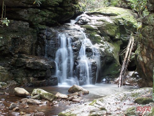
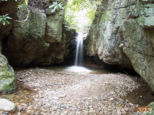
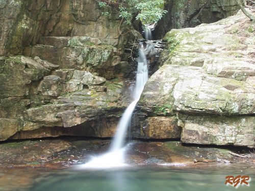
Blue Hole Falls (4) 45'
Waypoint: CTF001 36.432900,-82.072600
County: Carter landforms of Carter county
Locale: Cherokee National Forest
popup list of
nearby landforms (mileage, bearing)
MAPS
Select one of the following maps to display this waypoint (WGS84).
GPS
Remarks:
A series of 4 falls.
photos courtesy of Robert Robbins
Tennessee landforms
home
arches
waterfalls
rocks
peaks
balds
sinks
lakes
regions
county
GSMNP landforms (TN/NC)
BSF landforms (TN/KY)
or nearby
lookout towers
Chuck Sutherland's www.tnlandforms.com the future (2024)
 ©
Tom Dunigan
©
Tom Dunigan