Tennessee Landforms -- arches and natural bridges| WGS84 |
| 36.037910 | -88.257600 |
| 36° 2.275'N | 88° 15.456'W |
| 36° 2' 16.5"N | 88° 15' 27.4"W |
| 16S 386707E 3988885N |
| convert to NAD27 |
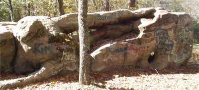
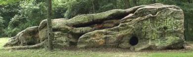
Hollow Rock 2x2
Waypoint: CRA001 36.037910,-88.257600
County: Carroll landforms of Carroll county
Locale: park
NABSQNO 16S-386707-3988885
popup list of
nearby landforms (mileage, bearing)
MAPS
Select one of the following maps to display this waypoint (WGS84).
GPS
Remarks:
References: C/P:2A
The
story of the rock
 from here
Tennessee landforms
home
arches
waterfalls
rocks
peaks
balds
sinks
lakes
regions
county
GSMNP landforms (TN/NC)
BSF landforms (TN/KY)
or nearby
lookout towers
Chuck Sutherland's www.tnlandforms.com the future (2024)
 ©
Tom Dunigan
©
Tom Dunigan