Tennessee Landforms -- waterfalls| WGS84 |
| 35.757032 | -83.178470 |
| 35° 45.422'N | 83° 10.708'W |
| 35° 45' 25.3"N | 83° 10' 42.5"W |
| 17S 303044E 3959189N |
| convert to NAD27 |
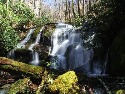
Panther Branch Falls 20'
Waypoint: COF011 35.757032,-83.178470
County: Cocke landforms of Cocke county
Locale: Great Smoky Mountains National Park
popup list of
nearby landforms (mileage, bearing)
MAPS
Select one of the following maps to display this waypoint (WGS84).
GPS
Remarks:
Reference and photo: Mike Gourley
 off-trail
Tennessee landforms
home
arches
waterfalls
rocks
peaks
balds
sinks
lakes
regions
county
GSMNP landforms (TN/NC)
BSF landforms (TN/KY)
or nearby
lookout towers
Chuck Sutherland's www.tnlandforms.com the future (2024)
 ©
Tom Dunigan
©
Tom Dunigan