 Photo by Gregory Plumb, Author of
Waterfalls of Tennessee
Photo by Gregory Plumb, Author of
Waterfalls of Tennessee
| WGS84 | |
| 36.146900 | -87.122500 |
| 36° 8.814'N | 87° 7.35'W |
| 36° 8' 48.8"N | 87° 7' 21"W |
| 16S 488980E 4000249N | |
| convert to NAD27 | |
MAPS
Select one of the following maps to display this waypoint (WGS84).
GPS
Remarks:
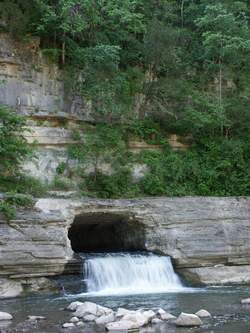
small man-made falls falling out of the tunnel, see picture
Photo by Gregory Plumb, Author of
Waterfalls of Tennessee