Tennessee Landforms -- waterfalls| WGS84 |
| 35.412780 | -86.179170 |
| 35° 24.767'N | 86° 10.75'W |
| 35° 24' 46"N | 86° 10' 45"W |
| 16S 574525E 3919130N |
| convert to NAD27 |
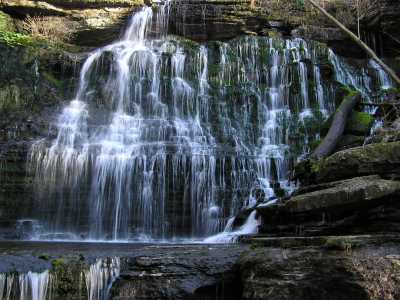
Machine Falls 60'
Waypoint: CFF009 35.412780,-86.179170
County: Coffee landforms of Coffee county
Locale: TNNA
popup list of
nearby landforms (mileage, bearing)
MAPS
Select one of the following maps to display this waypoint (WGS84).
GPS
Remarks:
part of Short Springs State Natural Area
Tennessee landforms
home
arches
waterfalls
rocks
peaks
balds
sinks
lakes
regions
county
GSMNP landforms (TN/NC)
BSF landforms (TN/KY)
or nearby
lookout towers
Chuck Sutherland's www.tnlandforms.com the future (2024)
 ©
Tom Dunigan
©
Tom Dunigan