 Photo by Gregory Plumb, Author of
Waterfalls of Tennessee
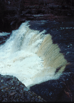
Photo by Gregory Plumb, Author of
Waterfalls of Tennessee
| WGS84 | |
| 35.485000 | -86.108060 |
| 35° 29.1'N | 86° 6.484'W |
| 35° 29' 6"N | 86° 6' 29"W |
| 16S 580909E 3927195N | |
| convert to NAD27 | |
MAPS
Select one of the following maps to display this waypoint (WGS84).
GPS
Remarks:
Photo by Gregory Plumb, Author of
Waterfalls of Tennessee
Chris Oliver reports smaller falls upstream, photo