Tennessee Landforms -- rock formations| WGS84 |
| 36.470950 | -84.012600 |
| 36° 28.257'N | 84° 0.756'W |
| 36° 28' 15.4"N | 84° 0' 45.4"W |
| 16S 767673E 4040336N |
| convert to NAD27 |
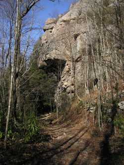
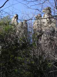
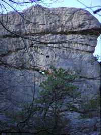
Hangover Rock
Waypoint: CAR003 36.470950,-84.012600
County: Campbell landforms of Campbell county
popup list of
nearby landforms (mileage, bearing)
MAPS
Select one of the following maps to display this waypoint (WGS84).
GPS
Remarks:
Interesting cliff lines in the vicinity of this overhanging rock.
Tennessee landforms
home
arches
waterfalls
rocks
peaks
balds
sinks
lakes
regions
county
GSMNP landforms (TN/NC)
BSF landforms (TN/KY)
or nearby
lookout towers
Chuck Sutherland's www.tnlandforms.com the future (2024)
 ©
Tom Dunigan
©
Tom Dunigan