Tennessee Landforms -- waterfalls| WGS84 |
| 36.378490 | -84.175480 |
| 36° 22.709'N | 84° 10.529'W |
| 36° 22' 42.5"N | 84° 10' 31.7"W |
| 16S 753376E 4029636N |
| convert to NAD27 |
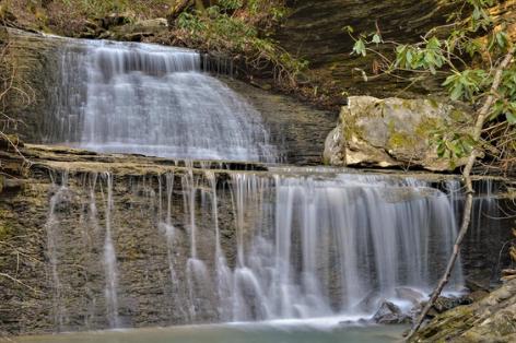
Patricia Falls 15'
Waypoint: CAF025 36.378490,-84.175480
County: Campbell landforms of Campbell county
Locale: RoyalBlue
popup list of
nearby landforms (mileage, bearing)
MAPS
Select one of the following maps to display this waypoint (WGS84).
GPS
Remarks:
Reference and photo: Daniel Hutchison
Tennessee landforms
home
arches
waterfalls
rocks
peaks
balds
sinks
lakes
regions
county
GSMNP landforms (TN/NC)
BSF landforms (TN/KY)
or nearby
lookout towers
Chuck Sutherland's www.tnlandforms.com the future (2024)
 ©
Tom Dunigan
©
Tom Dunigan