Tennessee Landforms -- waterfalls| WGS84 |
| 36.358700 | -84.216000 |
| 36° 21.522'N | 84° 12.96'W |
| 36° 21' 31.3"N | 84° 12' 57.6"W |
| 16S 749804E 4027334N |
| convert to NAD27 |
Flat Woods Falls 55'
Waypoint: CAF014 36.358700,-84.216000
County: Campbell landforms of Campbell county
Locale: RoyalBlue
popup list of
nearby landforms (mileage, bearing)
MAPS
Select one of the following maps to display this waypoint (WGS84).
GPS
Remarks:
Reference: Kevin Baker
Stairs lead down to a pair of ledge falls, total drop about 55', wet-weather
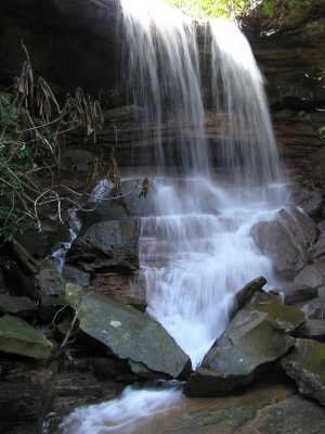 upper falls 30'
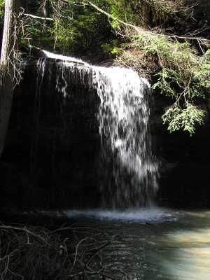 lower falls 25'
Tennessee landforms
home
arches
waterfalls
rocks
peaks
balds
sinks
lakes
regions
county
GSMNP landforms (TN/NC)
BSF landforms (TN/KY)
or nearby
lookout towers
Chuck Sutherland's www.tnlandforms.com the future (2024)
 ©
Tom Dunigan
©
Tom Dunigan