Tennessee Landforms -- arches and natural bridges| WGS84 |
| 36.377000 | -84.146110 |
| 36° 22.62'N | 84° 8.767'W |
| 36° 22' 37.2"N | 84° 8' 46"W |
| 16S 756016E 4029548N |
| convert to NAD27 |
CT eyelets
Waypoint: CAA015 36.377000,-84.146110
County: Campbell landforms of Campbell county
Locale: Cumberland Trail
NABSQNO 16S-756016-4029548
popup list of
nearby landforms (mileage, bearing)
MAPS
Select one of the following maps to display this waypoint (WGS84).
GPS
Remarks:
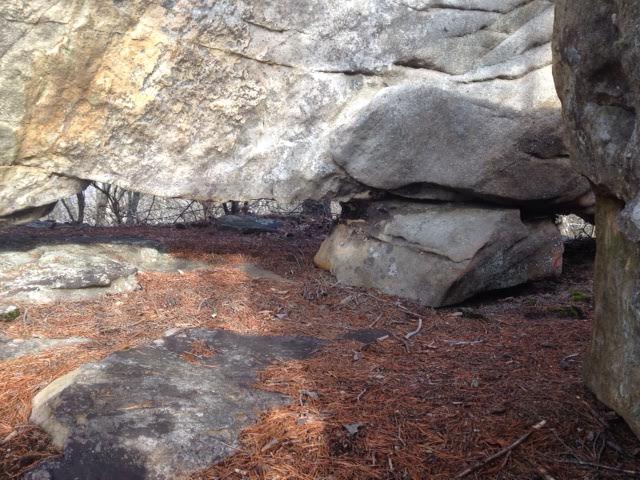
3 small openings along Cumberland Trail
Tennessee landforms
home
arches
waterfalls
rocks
peaks
balds
sinks
lakes
regions
county
GSMNP landforms (TN/NC)
BSF landforms (TN/KY)
or nearby
lookout towers
Chuck Sutherland's www.tnlandforms.com the future (2024)
 ©
Tom Dunigan
©
Tom Dunigan