Tennessee Landforms -- arches and natural bridges| WGS84 |
| 36.580940 | -84.046360 |
| 36° 34.856'N | 84° 2.782'W |
| 36° 34' 51.4"N | 84° 2' 46.9"W |
| 16S 764273E 4052448N |
| convert to NAD27 |
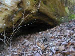
Crawl Space 4x2
Waypoint: CAA014 36.580940,-84.046360
County: Campbell landforms of Campbell county
NABSQNO 16S-764273-4052448
popup list of
nearby landforms (mileage, bearing)
MAPS
Select one of the following maps to display this waypoint (WGS84).
GPS
Remarks:
Tennessee landforms
home
arches
waterfalls
rocks
peaks
balds
sinks
lakes
regions
county
GSMNP landforms (TN/NC)
BSF landforms (TN/KY)
or nearby
lookout towers
Chuck Sutherland's www.tnlandforms.com the future (2024)
 ©
Tom Dunigan
©
Tom Dunigan