Tennessee Landforms -- arches and natural bridges| WGS84 |
| 36.373500 | -84.266400 |
| 36° 22.41'N | 84° 15.984'W |
| 36° 22' 24.6"N | 84° 15' 59"W |
| 16S 745234E 4028847N |
| convert to NAD27 |
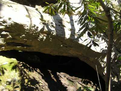
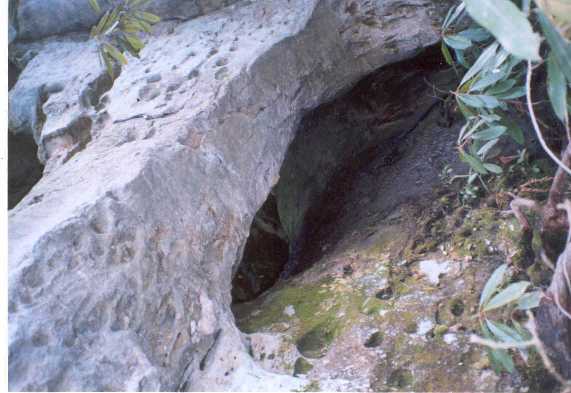
Titus Arch 7x7
Waypoint: CAA009 36.373500,-84.266400
County: Campbell landforms of Campbell county
Locale: RoyalBlue
NABSQNO 16S-745234-4028847
popup list of
nearby landforms (mileage, bearing)
MAPS
Select one of the following maps to display this waypoint (WGS84).
GPS
Remarks:
Reference: Kevin Baker
off-trail at base of bluff N of power-line
 Kevin's photo
The Arch of Titus
Tennessee landforms
home
arches
waterfalls
rocks
peaks
balds
sinks
lakes
regions
county
GSMNP landforms (TN/NC)
BSF landforms (TN/KY)
or nearby
lookout towers
Chuck Sutherland's www.tnlandforms.com the future (2024)
 ©
Tom Dunigan
©
Tom Dunigan