Tennessee Landforms -- arches and natural bridges| WGS84 |
| 36.470900 | -83.989600 |
| 36° 28.254'N | 83° 59.376'W |
| 36° 28' 15.2"N | 83° 59' 22.6"W |
| 17S 232129E 4040336N |
| convert to NAD27 |
Koker Transom 9x10
Waypoint: CAA008 36.470900,-83.989600
County: Campbell landforms of Campbell county
Locale: CT
NABSQNO 17S-232129-4040336
popup list of
nearby landforms (mileage, bearing)
MAPS
Select one of the following maps to display this waypoint (WGS84).
GPS
Remarks:
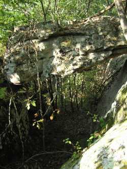
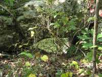 small 3x3 arch nearby to the west
Tennessee landforms
home
arches
waterfalls
rocks
peaks
balds
sinks
lakes
regions
county
GSMNP landforms (TN/NC)
BSF landforms (TN/KY)
or nearby
lookout towers
Chuck Sutherland's www.tnlandforms.com the future (2024)
 ©
Tom Dunigan
©
Tom Dunigan