Tennessee Landforms -- arches and natural bridges| WGS84 |
| 36.448000 | -84.051100 |
| 36° 26.88'N | 84° 3.066'W |
| 36° 26' 52.8"N | 84° 3' 4"W |
| 16S 764301E 4037683N |
| convert to NAD27 |
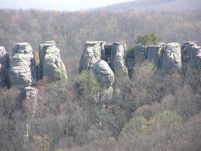
Chimney Rocks Arches 12x45
Waypoint: CAA004 36.448000,-84.051100
County: Campbell landforms of Campbell county
Locale: CT
NABSQNO 16S-764301-4037683
popup list of
nearby landforms (mileage, bearing)
MAPS
Select one of the following maps to display this waypoint (WGS84).
GPS
Remarks:
An arch that will be a chimney someday, and a window high in the
chimneys visible from the west. Many
chimney's nearby.
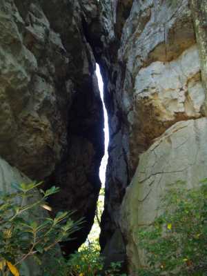
 high window
Tennessee landforms
home
arches
waterfalls
rocks
peaks
balds
sinks
lakes
regions
county
GSMNP landforms (TN/NC)
BSF landforms (TN/KY)
or nearby
lookout towers
Chuck Sutherland's www.tnlandforms.com the future (2024)
 ©
Tom Dunigan
©
Tom Dunigan