Tennessee Landforms -- waterfalls| WGS84 |
| 35.522450 | -83.960370 |
| 35° 31.347'N | 83° 57.622'W |
| 35° 31' 20.8"N | 83° 57' 37.3"W |
| 17S 231550E 3935015N |
| convert to NAD27 |
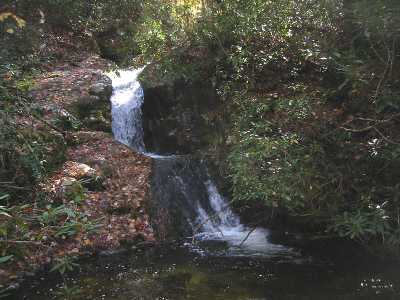
Bunker Hill Br Cascade 16'
Waypoint: BTF033 35.522450,-83.960370
County: Blount landforms of Blount county
Locale: Great Smoky Mountains National Park
popup list of
nearby landforms (mileage, bearing)
MAPS
Select one of the following maps to display this waypoint (WGS84).
GPS
Remarks:
Reference & photo: Steve Higdon
 off-trail
Tennessee landforms
home
arches
waterfalls
rocks
peaks
balds
sinks
lakes
regions
county
GSMNP landforms (TN/NC)
BSF landforms (TN/KY)
or nearby
lookout towers
Chuck Sutherland's www.tnlandforms.com the future (2024)
 ©
Tom Dunigan
©
Tom Dunigan