Tennessee Landforms -- waterfalls| WGS84 |
| 35.677670 | -83.888490 |
| 35° 40.66'N | 83° 53.309'W |
| 35° 40' 39.6"N | 83° 53' 18.5"W |
| 17S 238576E 3952043N |
| convert to NAD27 |
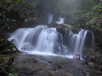
Gold Creek Falls 22'
Waypoint: BTF032 35.677670,-83.888490
County: Blount landforms of Blount county
Locale: private
popup list of
nearby landforms (mileage, bearing)
MAPS
Select one of the following maps to display this waypoint (WGS84).
GPS
Remarks:
Located on Flat Creek based on
1929 Garner photo of
hand-drawn map
A number of 6 and 8 foot drops upstream, off-trail.
Tennessee landforms
home
arches
waterfalls
rocks
peaks
balds
sinks
lakes
regions
county
GSMNP landforms (TN/NC)
BSF landforms (TN/KY)
or nearby
lookout towers
Chuck Sutherland's www.tnlandforms.com the future (2024)
 ©
Tom Dunigan
©
Tom Dunigan