Tennessee Landforms -- waterfalls| WGS84 |
| 35.665200 | -83.719000 |
| 35° 39.912'N | 83° 43.14'W |
| 35° 39' 54.7"N | 83° 43' 8.4"W |
| 17S 253882E 3950222N |
| convert to NAD27 |
Rush Branch Falls 20'
Waypoint: BTF022 35.665200,-83.719000
County: Blount landforms of Blount county
Locale: Great Smoky Mountains National Park
popup list of
nearby landforms (mileage, bearing)
MAPS
Select one of the following maps to display this waypoint (WGS84).
GPS
Remarks:
Reference: Bill Stowell
off-trail, wet-weather cascade

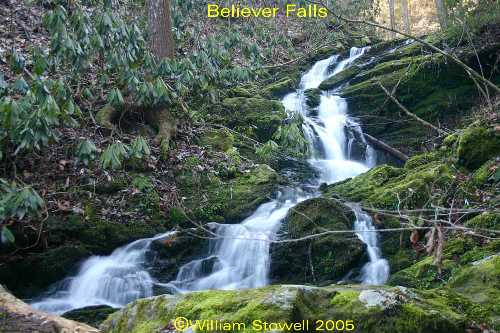 photo courtesy of Bill Stowell
Tennessee landforms
home
arches
waterfalls
rocks
peaks
balds
sinks
lakes
regions
county
GSMNP landforms (TN/NC)
BSF landforms (TN/KY)
or nearby
lookout towers
Chuck Sutherland's www.tnlandforms.com the future (2024)
 ©
Tom Dunigan
©
Tom Dunigan