Tennessee Landforms -- waterfalls| WGS84 |
| 35.627700 | -83.991100 |
| 35° 37.662'N | 83° 59.466'W |
| 35° 37' 39.7"N | 83° 59' 28"W |
| 17S 229118E 3946777N |
| convert to NAD27 |
Christy Hills Falls 10'
Waypoint: BTF018 35.627700,-83.991100
County: Blount landforms of Blount county
popup list of
nearby landforms (mileage, bearing)
MAPS
Select one of the following maps to display this waypoint (WGS84).
GPS
Remarks:
Reference: Robert Robbins and Dana Koogler, see Garner 1900
black & white photo
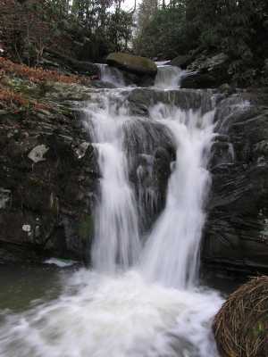 on Turkeypen Branch
Tennessee landforms
home
arches
waterfalls
rocks
peaks
balds
sinks
lakes
regions
county
GSMNP landforms (TN/NC)
BSF landforms (TN/KY)
or nearby
lookout towers
Chuck Sutherland's www.tnlandforms.com the future (2024)
 ©
Tom Dunigan
©
Tom Dunigan