Tennessee Landforms -- waterfalls| WGS84 |
| 35.562300 | -83.800500 |
| 35° 33.738'N | 83° 48.03'W |
| 35° 33' 44.3"N | 83° 48' 1.8"W |
| 17S 246177E 3939012N |
| convert to NAD27 |
Mill Creek Cascade
Waypoint: BTF010 35.562300,-83.800500
County: Blount landforms of Blount county
Locale: Great Smoky Mountains National Park
popup list of
nearby landforms (mileage, bearing)
MAPS
Select one of the following maps to display this waypoint (WGS84).
GPS
Remarks:
Reference: Wise, description
long cascade, off-trail.
(old wagon road, see 1931 map above)
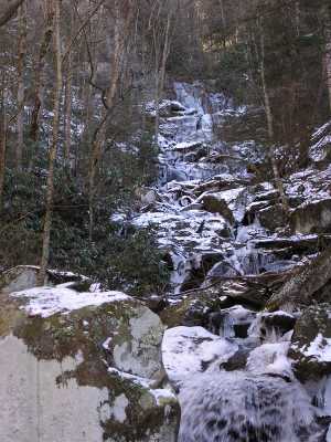
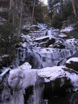
There is a small arch at the top of the falls.
Tennessee landforms
home
arches
waterfalls
rocks
peaks
balds
sinks
lakes
regions
county
GSMNP landforms (TN/NC)
BSF landforms (TN/KY)
or nearby
lookout towers
Chuck Sutherland's www.tnlandforms.com the future (2024)
 ©
Tom Dunigan
©
Tom Dunigan