Tennessee Landforms -- arches and natural bridges| WGS84 |
| 35.833400 | -84.068300 |
| 35° 50.004'N | 84° 4.098'W |
| 35° 50' 0.2"N | 84° 4' 5.9"W |
| 16S 764818E 3969439N |
| convert to NAD27 |
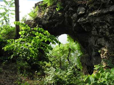
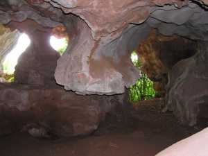
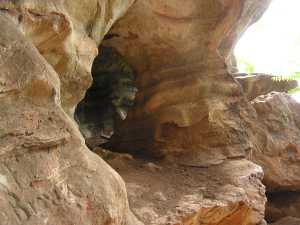
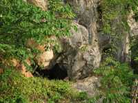
Sheep Pen Bluff Arch 10x15
Waypoint: BTA005 35.833400,-84.068300
County: Blount landforms of Blount county
Locale: Fort Loudoun
NABSQNO 16S-764818-3969439
popup list of
nearby landforms (mileage, bearing)
MAPS
Select one of the following maps to display this waypoint (WGS84).
GPS
Remarks:
A limestone arch high on the bluff above the lake. Smaller arches and
alcoves in the bluff wall.
Garner's 1890
black & white photos of Sheep Pen Bluff.
Tennessee landforms
home
arches
waterfalls
rocks
peaks
balds
sinks
lakes
regions
county
GSMNP landforms (TN/NC)
BSF landforms (TN/KY)
or nearby
lookout towers
Chuck Sutherland's www.tnlandforms.com the future (2024)
 ©
Tom Dunigan
©
Tom Dunigan