Tennessee Landforms -- arches and natural bridges| WGS84 |
| 35.637000 | -83.748870 |
| 35° 38.22'N | 83° 44.932'W |
| 35° 38' 13.2"N | 83° 44' 55.9"W |
| 17S 251090E 3947168N |
| convert to NAD27 |
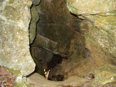
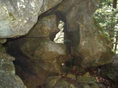
Whiteoak Windows 2x3
Waypoint: BTA001 35.637000,-83.748870
County: Blount landforms of Blount county
Locale: Great Smoky Mountains National Park
NABSQNO 17S-251090-3947168
popup list of
nearby landforms (mileage, bearing)
MAPS
Select one of the following maps to display this waypoint (WGS84).
GPS
Remarks:
A couple of small windows high on the west edge of the rock wall in Whiteoak
Sinks. Not signficant in themselves, but if you're in the sink visiting the
sinkholes,
falls,
and caves, you might as well search these out.
See geology
info and pics
Offtrail/manway.
Tennessee landforms
home
arches
waterfalls
rocks
peaks
balds
sinks
lakes
regions
county
GSMNP landforms (TN/NC)
BSF landforms (TN/KY)
or nearby
lookout towers
Chuck Sutherland's www.tnlandforms.com the future (2024)
 ©
Tom Dunigan
©
Tom Dunigan