Tennessee Landforms -- waterfalls| WGS84 |
| 36.206518 | -84.075498 |
| 36° 12.391'N | 84° 4.53'W |
| 36° 12' 23.5"N | 84° 4' 31.8"W |
| 16S 762924E 4010820N |
| convert to NAD27 |
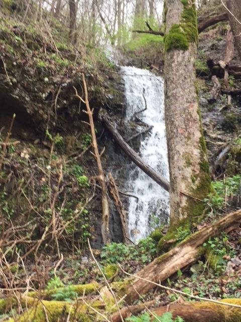
Riverview Falls 35'
Waypoint: ANF009 36.206518,-84.075498
County: Anderson landforms of Anderson county
popup list of
nearby landforms (mileage, bearing)
MAPS
Select one of the following maps to display this waypoint (WGS84).
GPS
Remarks:
wet-weather falls
Tennessee landforms
home
arches
waterfalls
rocks
peaks
balds
sinks
lakes
regions
county
GSMNP landforms (TN/NC)
BSF landforms (TN/KY)
or nearby
lookout towers
Chuck Sutherland's www.tnlandforms.com the future (2024)
 ©
Tom Dunigan
©
Tom Dunigan