Tennessee Landforms -- waterfalls| WGS84 |
| 36.109400 | -84.300600 |
| 36° 6.564'N | 84° 18.036'W |
| 36° 6' 33.8"N | 84° 18' 2.2"W |
| 16S 742982E 3999457N |
| convert to NAD27 |
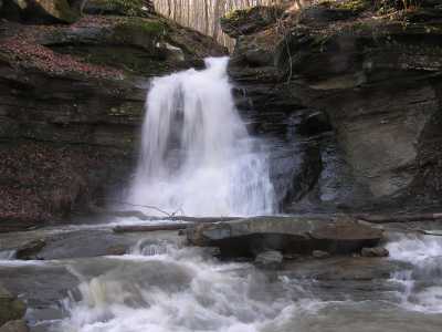
Stony Flat Falls 28'
Waypoint: ANF001 36.109400,-84.300600
County: Anderson landforms of Anderson county
Locale: windrock
popup list of
nearby landforms (mileage, bearing)
MAPS
Select one of the following maps to display this waypoint (WGS84).
GPS
Remarks:
A wet-weather falls along ATV trail #16.
Tennessee landforms
home
arches
waterfalls
rocks
peaks
balds
sinks
lakes
regions
county
GSMNP landforms (TN/NC)
BSF landforms (TN/KY)
or nearby
lookout towers
Chuck Sutherland's www.tnlandforms.com the future (2024)
 ©
Tom Dunigan
©
Tom Dunigan